Oman Country Map: Your Essential Guide to Sultanate’s Hidden Treasures
Oman’s territory stretches across 309,500 square kilometers along the southeastern coast of the Arabian Peninsula. The country’s landscape tells a story of remarkable diversity, from Mount Shams’s soaring peaks at 9,777 feet to the ancient UNESCO-recognized aflāj irrigation systems.
Oman Map reveals that 89% of its 5.3 million residents live in urban areas. The terrain changes dramatically throughout the region. You’ll discover every corner of this nation, from the rugged Hajar Mountains to the coastal areas where temperatures soar to 110°F (43°C).
This guide will show Oman’s unique geographical features, major cities, and hidden gems that make this Arabian nation special.
Understanding Oman’s Geographic Layout
Oman is located at the southeastern edge of the Arabian Peninsula. It serves as a strategic gateway between the Persian Gulf and the Arabian Sea.
Location and borders
You’ll find Oman between 16°N and 28°N latitude. The country shares its borders with three neighbors. The United Arab Emirates sits to the northwest, Saudi Arabia to the west, and Yemen to the southwest. The country also shares sea borders with Iran and Pakistan across the Gulf of Oman.
Key regions overview
The sultanate breaks down into eleven governorates (muhafazah):
 Major geographical features
The country’s landscape shows three distinct zones. The first zone has two fertile coastal strips. One strip runs from Muscat along the northern coast, while another wraps around Salalah in the south.
The second zone features the mountainous regions, with the Hajar Mountains dominating the north. These impressive peaks rise above 4,800 feet. Mount Shams stands as the country’s highest point at 9,777 feet.
The central desert plain makes up the third zone, where the massive Rub Al Khali (Empty Quarter) spreads across the landscape. This desert covers 82% of Oman’s total land. Mountain ranges take up 15%, and the coastal plain makes up just 3%.
The Musandam Peninsula, an exclave cut off from mainland Oman by the UAE, watches over the strategic Strait of Hormuz. Oman’s territory also extends to offshore areas, including Masirah Island to the east and the Al-Hallāniyyah Island group along the southern coast.
Exploring Oman’s Coastal Regions
A magnificent coastline stretches 3,165 kilometers across Oman’s eastern edge, showcasing the country’s maritime heritage and natural splendor.
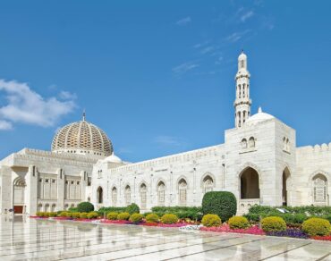
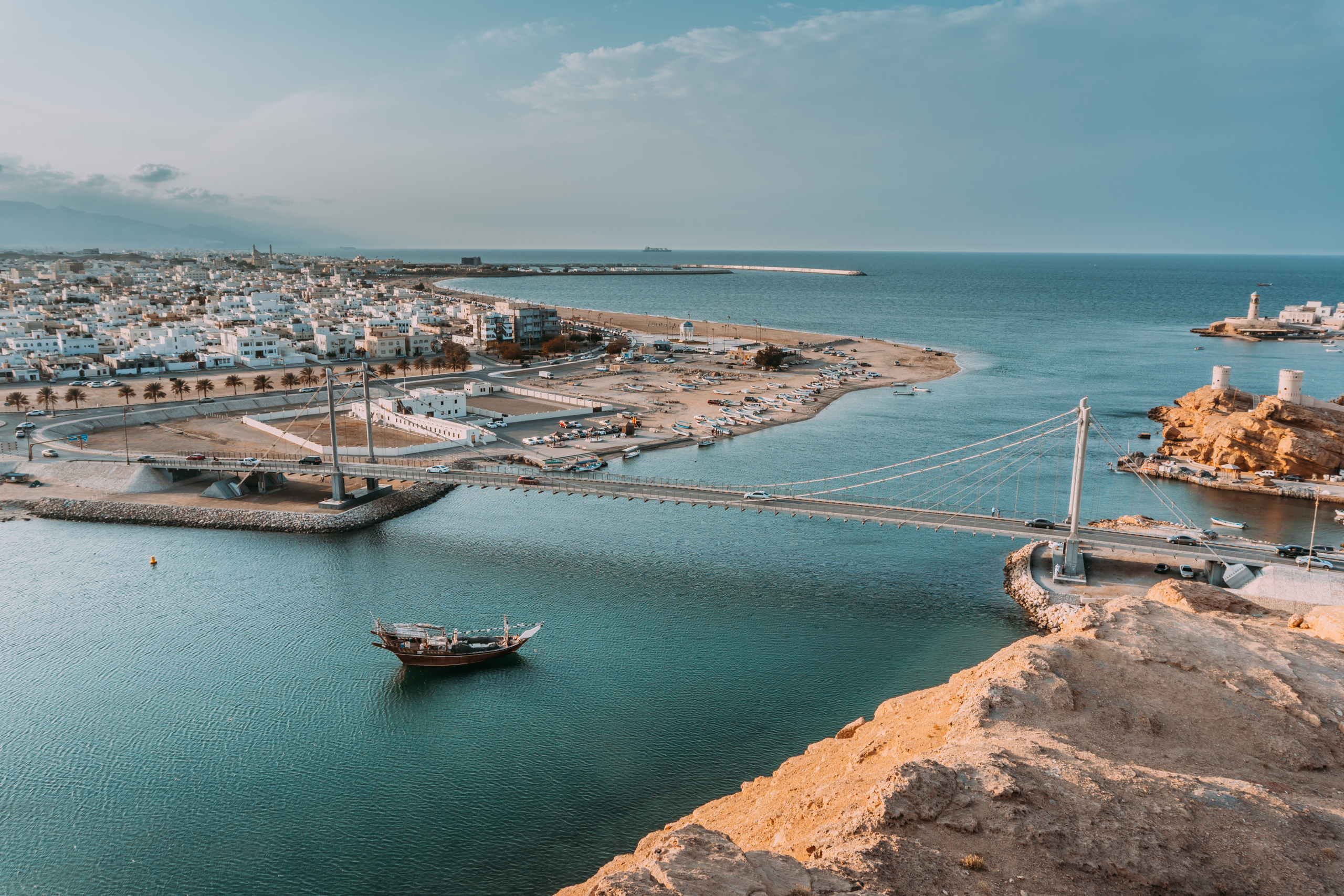
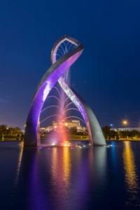
Muscat and surroundings
The capital region creates a stunning contrast between jagged-peaked mountains and the royal blue sea. Muscat’s architecture seamlessly combines traditional sophistication with modern elements. White-washed buildings, intricate domes, and ancient forts rest peacefully in rocky hills.
Qurum Beach stands out among the city’s coastal attractions with its 4-kilometer stretch along the waterfront. Shallow waters and extended high tides make this family-friendly destination perfect for relaxed activities. Nature enthusiasts will find Bandar al Khiran appealing with its turquoise inlets just 45 minutes from the city center. These spots provide excellent conditions for snorkeling and kayaking.
Visitors can experience the harmonious blend of traditional dhows and modern vessels at the Mutrah Corniche, a vibrant 3-kilometer promenade along the harbor. The area buzzes with activity during late afternoons as locals and tourists explore the maze-like streets around the historic Mutrah Souq.
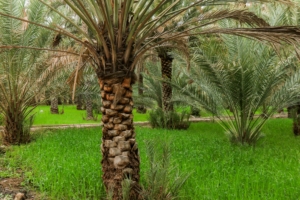
Al Batinah coastline
A fertile strip known as Al Batinah Coast lies between the sparkling Gulf of Oman and towering Hajar mountains. This densely populated region runs from Khatmat Malahah in the north to Ras al-Hamra in the south.
The region boasts several distinctive features:
Major geographical features
The country’s landscape shows three distinct zones. The first zone has two fertile coastal strips. One strip runs from Muscat along the northern coast, while another wraps around Salalah in the south.
The second zone features the mountainous regions, with the Hajar Mountains dominating the north. These impressive peaks rise above 4,800 feet. Mount Shams stands as the country’s highest point at 9,777 feet.
The central desert plain makes up the third zone, where the massive Rub Al Khali (Empty Quarter) spreads across the landscape. This desert covers 82% of Oman’s total land. Mountain ranges take up 15%, and the coastal plain makes up just 3%.
The Musandam Peninsula, an exclave cut off from mainland Oman by the UAE, watches over the strategic Strait of Hormuz. Oman’s territory also extends to offshore areas, including Masirah Island to the east and the Al-Hallāniyyah Island group along the southern coast.
Exploring Oman’s Coastal Regions
A magnificent coastline stretches 3,165 kilometers across Oman’s eastern edge, showcasing the country’s maritime heritage and natural splendor.
Muscat and surroundings
The capital region creates a stunning contrast between jagged-peaked mountains and the royal blue sea. Muscat’s architecture seamlessly combines traditional sophistication with modern elements. White-washed buildings, intricate domes, and ancient forts rest peacefully in rocky hills.
Qurum Beach stands out among the city’s coastal attractions with its 4-kilometer stretch along the waterfront. Shallow waters and extended high tides make this family-friendly destination perfect for relaxed activities. Nature enthusiasts will find Bandar al Khiran appealing with its turquoise inlets just 45 minutes from the city center. These spots provide excellent conditions for snorkeling and kayaking.
Visitors can experience the harmonious blend of traditional dhows and modern vessels at the Mutrah Corniche, a vibrant 3-kilometer promenade along the harbor. The area buzzes with activity during late afternoons as locals and tourists explore the maze-like streets around the historic Mutrah Souq.
Al Batinah coastline
A fertile strip known as Al Batinah Coast lies between the sparkling Gulf of Oman and towering Hajar mountains. This densely populated region runs from Khatmat Malahah in the north to Ras al-Hamra in the south.
The region boasts several distinctive features:
 Discovering the Mountain Regions
Oman’s mountain regions create a dramatic backdrop that defines the country’s varied terrain. These peaks give visitors amazing experiences and stunning views all year round.
Hajar Mountains
The Al Hajar Mountains run from the Musandam Peninsula to Sur, a town famous for dhow-making. This mighty range acts as Oman’s geological spine and stretches along the entire east coast. We explored its rugged landscapes and deep wadis that give outdoor enthusiasts plenty to do.
Jebel Akhdar
The “Green Mountain” sits at 2,000 meters above sea level with its huge Saiq Plateau. It stands out against the dry landscape around it. This mountain mass stretches 80 kilometers long and 32 kilometers wide. A network of wadis and terraces keeps this region fertile and green.
The area has several unique features:
Discovering the Mountain Regions
Oman’s mountain regions create a dramatic backdrop that defines the country’s varied terrain. These peaks give visitors amazing experiences and stunning views all year round.
Hajar Mountains
The Al Hajar Mountains run from the Musandam Peninsula to Sur, a town famous for dhow-making. This mighty range acts as Oman’s geological spine and stretches along the entire east coast. We explored its rugged landscapes and deep wadis that give outdoor enthusiasts plenty to do.
Jebel Akhdar
The “Green Mountain” sits at 2,000 meters above sea level with its huge Saiq Plateau. It stands out against the dry landscape around it. This mountain mass stretches 80 kilometers long and 32 kilometers wide. A network of wadis and terraces keeps this region fertile and green.
The area has several unique features:
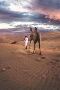 Central desert regions
Oman’s central desert lies between 18° and 22°30′ N latitude and takes up about half of the country’s surface area. The ground beneath consists of horizontal, mid-Tertiary limestone remnants of ancient sea-bed levels.
The central plains showcase scattered Acacia tortilis trees, various shrubs, and perennial grasses. The western edge next to the Rub al-Khali supports psammophilic vegetation that thrives in sandy conditions.
The Arabian Oryx Sanctuary stands as one of the region’s most important sites and gives shelter to wildlife of all types. Beyond the Arabian oryx, the sanctuary protects the houbara bustard, two species of gazelle, and ibex. Sandy wadi channels throughout the central desert support open woodlands of Prosopis cineraria.
Coastal fog has boosted species diversity in the eastern desert regions, especially in drainage channels and shallow depressions. The central desert stretches out as a big featureless plain with low gravel outcrops and wind-swept sandy plains. Several wadis flow from the Hajar mountains and southern escarpments into these central plains, which creates unique microhabitats.
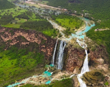
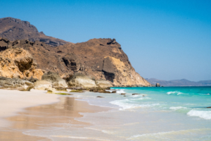
Southern Region of Dhofar
The Dhofar region reveals nature’s incredible diversity at Oman’s southern border. This special area runs from Ras ash-Sharbatat all the way to Yemen’s border, standing out from the rest of the Arabian Peninsula.
Salalah and surroundings
Salalah, Dhofar’s capital and Oman’s second-largest city, sits at 17°01′ N 54°05′ E. The city boasts a spectacular location between the curved Dhofar Mountains and the Arabian Sea. This creates a breathtaking view where the coast meets the mountains.
The area around Salalah features some amazing natural wonders:
Central desert regions
Oman’s central desert lies between 18° and 22°30′ N latitude and takes up about half of the country’s surface area. The ground beneath consists of horizontal, mid-Tertiary limestone remnants of ancient sea-bed levels.
The central plains showcase scattered Acacia tortilis trees, various shrubs, and perennial grasses. The western edge next to the Rub al-Khali supports psammophilic vegetation that thrives in sandy conditions.
The Arabian Oryx Sanctuary stands as one of the region’s most important sites and gives shelter to wildlife of all types. Beyond the Arabian oryx, the sanctuary protects the houbara bustard, two species of gazelle, and ibex. Sandy wadi channels throughout the central desert support open woodlands of Prosopis cineraria.
Coastal fog has boosted species diversity in the eastern desert regions, especially in drainage channels and shallow depressions. The central desert stretches out as a big featureless plain with low gravel outcrops and wind-swept sandy plains. Several wadis flow from the Hajar mountains and southern escarpments into these central plains, which creates unique microhabitats.
Southern Region of Dhofar
The Dhofar region reveals nature’s incredible diversity at Oman’s southern border. This special area runs from Ras ash-Sharbatat all the way to Yemen’s border, standing out from the rest of the Arabian Peninsula.
Salalah and surroundings
Salalah, Dhofar’s capital and Oman’s second-largest city, sits at 17°01′ N 54°05′ E. The city boasts a spectacular location between the curved Dhofar Mountains and the Arabian Sea. This creates a breathtaking view where the coast meets the mountains.
The area around Salalah features some amazing natural wonders:
 The monsoon region features
The Khareef, a special monsoon season from June to September, makes Dhofar unique in Arabia. Temperatures drop below 30°C during this time, and humidity soars above 90%.
The Khareef brings several amazing changes:
Salalah’s plain gets constant mist and drizzle, with about 25mm of rain in July and August. The surrounding escarpment catches clouds and doubles this rainfall.
These weather conditions create perfect growing conditions for:
The monsoon region features
The Khareef, a special monsoon season from June to September, makes Dhofar unique in Arabia. Temperatures drop below 30°C during this time, and humidity soars above 90%.
The Khareef brings several amazing changes:
Salalah’s plain gets constant mist and drizzle, with about 25mm of rain in July and August. The surrounding escarpment catches clouds and doubles this rainfall.
These weather conditions create perfect growing conditions for:
- Ad Dakhiliyah (Nizwa)
- Ad Dhahirah (Ibri)
- Al Batinah North (Sohar)
- Al Batinah South (Rustaq)
- Al Buraimi (Al-Buraimi)
- Al Wusta (Haima)
- Ash Sharqiyah North (Ibra)
- Ash Sharqiyah South (Sur)
- Dhofar (Salalah)
- Muscat (Capital)
- Musandam (Khasab)
Major geographical features
The country’s landscape shows three distinct zones. The first zone has two fertile coastal strips. One strip runs from Muscat along the northern coast, while another wraps around Salalah in the south.
The second zone features the mountainous regions, with the Hajar Mountains dominating the north. These impressive peaks rise above 4,800 feet. Mount Shams stands as the country’s highest point at 9,777 feet.
The central desert plain makes up the third zone, where the massive Rub Al Khali (Empty Quarter) spreads across the landscape. This desert covers 82% of Oman’s total land. Mountain ranges take up 15%, and the coastal plain makes up just 3%.
The Musandam Peninsula, an exclave cut off from mainland Oman by the UAE, watches over the strategic Strait of Hormuz. Oman’s territory also extends to offshore areas, including Masirah Island to the east and the Al-Hallāniyyah Island group along the southern coast.
Exploring Oman’s Coastal Regions
A magnificent coastline stretches 3,165 kilometers across Oman’s eastern edge, showcasing the country’s maritime heritage and natural splendor.
Muscat and surroundings
The capital region creates a stunning contrast between jagged-peaked mountains and the royal blue sea. Muscat’s architecture seamlessly combines traditional sophistication with modern elements. White-washed buildings, intricate domes, and ancient forts rest peacefully in rocky hills.
Qurum Beach stands out among the city’s coastal attractions with its 4-kilometer stretch along the waterfront. Shallow waters and extended high tides make this family-friendly destination perfect for relaxed activities. Nature enthusiasts will find Bandar al Khiran appealing with its turquoise inlets just 45 minutes from the city center. These spots provide excellent conditions for snorkeling and kayaking.
Visitors can experience the harmonious blend of traditional dhows and modern vessels at the Mutrah Corniche, a vibrant 3-kilometer promenade along the harbor. The area buzzes with activity during late afternoons as locals and tourists explore the maze-like streets around the historic Mutrah Souq.
Al Batinah coastline
A fertile strip known as Al Batinah Coast lies between the sparkling Gulf of Oman and towering Hajar mountains. This densely populated region runs from Khatmat Malahah in the north to Ras al-Hamra in the south.
The region boasts several distinctive features:
- Fine fortresses and semi-tropical oases
- Traditional fishing communities and vibrant fish markets
- Lush date plantations stretching between mountains and sea
- Natural hot springs near coastal settlements
Discovering the Mountain Regions
Oman’s mountain regions create a dramatic backdrop that defines the country’s varied terrain. These peaks give visitors amazing experiences and stunning views all year round.
Hajar Mountains
The Al Hajar Mountains run from the Musandam Peninsula to Sur, a town famous for dhow-making. This mighty range acts as Oman’s geological spine and stretches along the entire east coast. We explored its rugged landscapes and deep wadis that give outdoor enthusiasts plenty to do.
Jebel Akhdar
The “Green Mountain” sits at 2,000 meters above sea level with its huge Saiq Plateau. It stands out against the dry landscape around it. This mountain mass stretches 80 kilometers long and 32 kilometers wide. A network of wadis and terraces keeps this region fertile and green.
The area has several unique features:
- Traditional mountain villages with terraced gardens
- Prized pomegranate orchards and apricot groves
- Ancient falaj irrigation systems
- Damask rose gardens bloom in March
- Dunes that reach heights of 250 meters
- Reddish-orange terrain from feldspar deposits
- Brackish salt flats, like the Umm al Samim area
- Ancient lake beds that formed 6,000 to 2,000 years ago
Central desert regions
Oman’s central desert lies between 18° and 22°30′ N latitude and takes up about half of the country’s surface area. The ground beneath consists of horizontal, mid-Tertiary limestone remnants of ancient sea-bed levels.
The central plains showcase scattered Acacia tortilis trees, various shrubs, and perennial grasses. The western edge next to the Rub al-Khali supports psammophilic vegetation that thrives in sandy conditions.
The Arabian Oryx Sanctuary stands as one of the region’s most important sites and gives shelter to wildlife of all types. Beyond the Arabian oryx, the sanctuary protects the houbara bustard, two species of gazelle, and ibex. Sandy wadi channels throughout the central desert support open woodlands of Prosopis cineraria.
Coastal fog has boosted species diversity in the eastern desert regions, especially in drainage channels and shallow depressions. The central desert stretches out as a big featureless plain with low gravel outcrops and wind-swept sandy plains. Several wadis flow from the Hajar mountains and southern escarpments into these central plains, which creates unique microhabitats.
Southern Region of Dhofar
The Dhofar region reveals nature’s incredible diversity at Oman’s southern border. This special area runs from Ras ash-Sharbatat all the way to Yemen’s border, standing out from the rest of the Arabian Peninsula.
Salalah and surroundings
Salalah, Dhofar’s capital and Oman’s second-largest city, sits at 17°01′ N 54°05′ E. The city boasts a spectacular location between the curved Dhofar Mountains and the Arabian Sea. This creates a breathtaking view where the coast meets the mountains.
The area around Salalah features some amazing natural wonders:
- Wadi Darbat: A beautiful valley with 100-meter-high waterfalls
- Marneef Cave: A unique rocky spot where water shoots up to 30 meters through blowholes
- Fazayah Beach: Beautiful shores with crystal-clear waters and impressive rock formations
The monsoon region features
The Khareef, a special monsoon season from June to September, makes Dhofar unique in Arabia. Temperatures drop below 30°C during this time, and humidity soars above 90%.
The Khareef brings several amazing changes:
Salalah’s plain gets constant mist and drizzle, with about 25mm of rain in July and August. The surrounding escarpment catches clouds and doubles this rainfall.
These weather conditions create perfect growing conditions for:
- Tropical fruits like coconuts, pineapples, and papayas
- Green meadows and seasonal waterfalls
- Frankincense trees in the UNESCO-listed Wadi Dawkah